 |
Good GPS, bad service
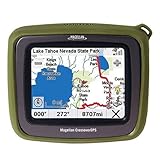
Internally this unit is known as Magellan Roadmate 2500T. This is important because if you want to purchase extra SD memory, vendors will typically tell you whether their memory is supported or not. The maximum SD card this GPS can handle is 2 GB even though the documentation says it it is "unlimited". It is very much limited, it also can not handle newer SDHC card. I have had luck with SanDisk 2GB *regular* SD flash memory. T in '2500T' stands for Traffic, meaning it can be extended with a traffic updater if so desired. Now the review: -- The good: Crossover has a really good satellite visibility, it can see the satellites from the house, from the tunnels, from inside the 27 story high office building, in fact from inside the elevator shaft of that building. The automotive navigation logic is fine, it will get you from place to place, but it seems to recalculate things very often. The prompter voice is Ok, you can't change it though, On the other GPS (Tomtom) I was able to set up Kim Cattrall's voice, this one is just one voice that sounds like airport lady. -- Marine functionality: You need to get so-called BlueNav maps, they come in 2 varieties, downloadable and preloaded into secure SD card. Both varieties are expensive, if you want those it is better wait for some sort of a deal, I was able to get mine on AAA sale event at a 25% discount. Downloadable maps are more expensive, you get a single region but you can transfer it into as many SD cards as you want, as long as they are being used on the original device. You can obviously mix and match the regions as you go. The regions themselves are quite small, typically a state or sometime half the state. For example, Massachusetts region is from Ipswich Bay to Cape Cod Canal. SecureSD maps are a better deal, the regions included are multi-state but: a) they don't have tide information and b) if you lost them you lost them, you can't burn the maps into a new SD media. Once you purchase them they are tied up not only to the GPS device but also to the SD card (that's why it is called secure) you can't make a backup. --- The bad: The software that came with the unit is useless. Compared to Garmin or Fugawi it is like stone age. Their better software (VantagePoint) can't work with Crossover GPS at all. --- The ugly: The unit comes with the automotive maps from 2006. Why are there maps from 2006 when it is 2008 ? Because they want you to buy the updated maps, they cost $80 and it is a download. This is just plain wrong. Tomtom allows you do upgrade everything the moment you connect it to the computer. Also, customer support is in India, I had to call about the discount on maps. Weren't helpful at all. Overall, mixed bag. The unit itself is quite good, but the services around it (software, support, pricing, company friendliness) aren't.Old maps are a deal killer
Not a bad unit, read the other reviews, but the deal killer for anyone should be that the maps included are from August 2006, hopelessly out-of-date, and Magellan has the extremely anti-consumer policy on not providing free updates even with a recent purchase of this unit. You ask, you get a polite e-mail from India telling you you can pay $80 to buy an upgrade disk for the GPS you just bought. Neither Garmin nor TomTom "screw" their customers like this. Bottom line, stay away from Magellan.does everything but nothing good.
very disappointed with their maps. I called Tech support (India) and they told me they were 2006 maps. My home subdivision was established in 2003, yet none of it is included. Another friend lives in an older part of town (built in the late 70's early 80's) The Crossover cannot find him or any of his direct neighbors. I had issues with on-ramps listed where they are not, also a change done by our city many years ago. They say a new update is coming in 08 yet i will have to pay for it!!! I had an old Magellan from the late 90's with road maps and I would venture to say this one is not any better. Calculating trip times are not even close to realistic. The time was calculated off traveling 45 MPH when the speed limit on this highway was 65 MPH. I cannot recommend anyone buying this unit. I thought i could have a good all around unit but this does nothing good, I would have been better off buying separate units.Save your money
The concept of the unit is ok, and overall the device does work. Where things break down is with Magellan itself: Out of the box the maps on my crossover where out of date, and didn't show roads in my area that have been in place for 5-7 years. Garmin units showed the roads fine, and even other magellan's seem to know the road existed. Contacted Magellan tech support (they are out of India) and was informed that a map update was available. BUT, was informed I would have to pay $80 to purchase the updated maps. Unlike other vendors magellan doesn't give you the first update free or updates free the first year for the maps. If you buy it you are stuff with the maps on the unit unless you pay them for the new maps. As is the unit does work well, the topo maps are neat and the navigation works. But my unit is getting returned. There might be units out there with the latest firmware and maps on the shelves, but am not going to play russian roulette ordering units till I find one. Am horribly disappointed with Magellan's customer support. Save your money and get a unit that will be supported by the manufacturer. Buying a unit and then having to turn around and buy an $80 upgrade for it within the first 30 days to just bring it up to par with newer releases of same exact model that are on store shelves is absurd.Magellan Crossover -
Pros - Great Battery life, very intuitive to use, quite fast in tracking location, good street by street voice directions, ability to turn off touch screen is great (saves battery & means can leave in pocket etc without accidentally touching screen. Cons - No ability to save tracks, offload tracks (to Computer/mapping program), no ability to pre plan an exact route (on computer or mapping program) and upload to unit Summary - I am using the unit on a motocycle, in my pocket, using the voice directions via headphones. I wish I had known this infomration before purchase. Maybe I would have chosen the Garmin? This lack of feature means really difficult to pre route a specific trip, with every turn pre planned. However, this unit is great if using in a car to find out WHERE AM I? and HOW DO I GET TO <address> FROM HERE. POIs are very good. From a strange place, I could easily find the nearest Chevron, Super 8 Motel, Chinese restaruant etc. If I could upload a pre planned route, and save & offload tracks, this would be the perfect GPSKeyword : magellan
1 comment:
I think, Most of the Garmin GPS is best and give you best service. Every motorcycle lover used Garmin Zumo GPS. I mused most time Garmin zumo 550 Motorcycle gps https://bestmotorcyclelife.com/garmin-zumo-550-review
Post a Comment